On September 28, a 7.5 magnitude earthquake occurred in Indonesia. After that, a tsunami struck the island of Sulawesi. The victims of the disaster were almost two thousand people.
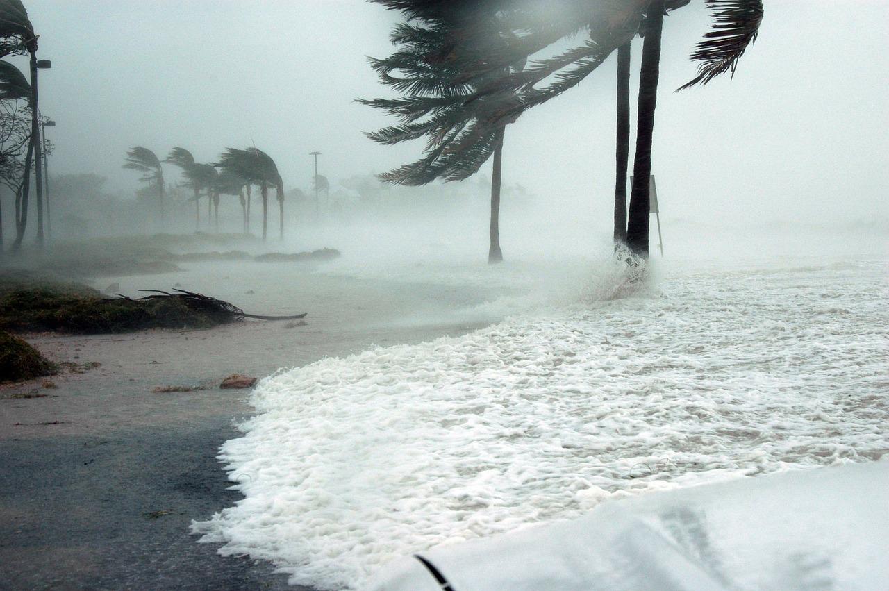
The earthquake and tsunami caused catastrophic damage to the island, and especially to the city of Palu. This is not the first time that earthquakes and tsunamis have caused massive casualties and destruction in Indonesia. But why?
The reason is the seismic activity in the region, the shape of the coastline of Indonesian islands, the vulnerability of infrastructure and imperfect early warning systems. All this makes tsunamis especially dangerous for Indonesia.
Seismic features
Indonesia belongs to the so-called Pacific Ring of Fire, an area of extremely high tectonic activity. Earthquakes are more frequent in this region than in other parts of the world, and they are harder to predict. It is known that the strongest earthquakes on the planet occur at the junction of tectonic plates, in so-called subduction zones.
In December 2004 and March 2005, such earthquakes occurred along the Sunda Trench, the deepest depression in the Indian Ocean, which begins off the coast of Myanmar. An earthquake of magnitude 9.1 triggered a devastating tsunami that killed nearly 250,000 people in the region.
Consequences of the tsunami
However, trying to track only strong earthquakes can distract from other dangers. Eastern Indonesia sits on many small unstable portions of the earth’s crust that respond to the movement of larger plates – the Australian, Zondo, Pacific, and Philippine plates.
The September earthquake started in the fault area between these small areas. Such events very rarely result in tsunamis. According to studies, earthquakes of magnitude seven to eight occur in this region about once every 700 years.
Coastline
Another important factor in the formation of a tsunami is the depth and topography of the seafloor. They determine the speed of the first waves. Strong earthquakes in subduction zones raise huge masses of water. These masses then fall and sometimes create a vortex below sea level. This is what causes the huge wave.
A wave that moves from the center of an earthquake may be small in height (rarely more than a meter), but its mass is enormous (this depends on the area affected by the earthquake).
Tsunami waves travel very fast, sometimes reaching the speed of a jet airplane. At a depth of two kilometers, they reach speeds of 700 kilometers per hour, and at greater depths up to a thousand kilometers per hour.
When such a wave reaches coastal shallow water, its speed decreases and its height increases. In the open sea, a tsunami rarely exceeds one meter in height, but on the coast these waves grow to five to ten meters. If the bottom rises sharply enough near the shore, this effect is amplified and the tsunami may reach tens of meters in height.
Although the waves slow down near the coast, their initial speed is high enough to inundate large areas of land. The speed of the waves is affected by the topography of the bottom: they move faster in deep areas and slow down in shallow areas. Sharp and steep bottom rises can even change the direction of the waves.
The shorelines of the islands of the Indonesian archipelago are very sharp, in its eastern part and on the island of Sulawesi especially. The city of Palu is located near a narrow, deep and long bay. It is in such bays that the most destructive and unpredictable tsunamis occur. The peculiarities of the landscape complicate the organization of accurate and timely notification of local residents.
How to escape from a tsunami
The easiest and most reliable way to escape from a tsunami is to climb to any elevation, the higher the better, at the first tremor and stay there for several hours. Often, however, an earthquake is not so easy to recognize.
Japan and Hawaii have effective early warning systems. It is not easy to launch one in Indonesia because of the poor communication infrastructure and the wide variety of languages spoken in the archipelago.
After the 2004 disaster, authorities in several Southeast Asian countries agreed to improve tsunami warning systems in the region. Today, such a system in Indonesia includes 134 sea level stations, 22 buoys connected to seismic sensors on the ocean floor, seismic stations on land, sirens in 55 areas, and an SMS warning system.
Long-term funding and support for an early warning system is a serious problem. It costs $250,000 to install one buoy with sensors and $50,000 annually to maintain it.
Three services are responsible for earthquake and tsunami warning and mitigation in Indonesia, which in recent years have suffered from budget deficits and internal struggles over division of duties and responsibilities.
The Palu tsunami showed that Indonesia’s current warning system is ineffective. Despite the earthquake, it did not show a tsunami threat. As a consequence, there was no tsunami alarm.
Of course, no early warning system can prevent strong earthquakes. Tsunamis with destruction and casualties will continue to occur in the future. However, with well-developed communications, the tragic consequences can be minimized.
In the case of earthquakes that occur close to beaches (a frequent occurrence in Indonesia), even a perfect warning system may not work fast enough. Indonesia’s geography and the hazardous coastal location of most of the country’s settlements make tsunamis a serious hazard, so more effort is needed to organize effective public awareness of the threat of such disasters.